Catalog Archive
Auction 105, Lot 88

"A Map of North America with the European Settlements & whatever else is remarkable in ye West Indies from the lastest and best Observations", Seale, Richard William

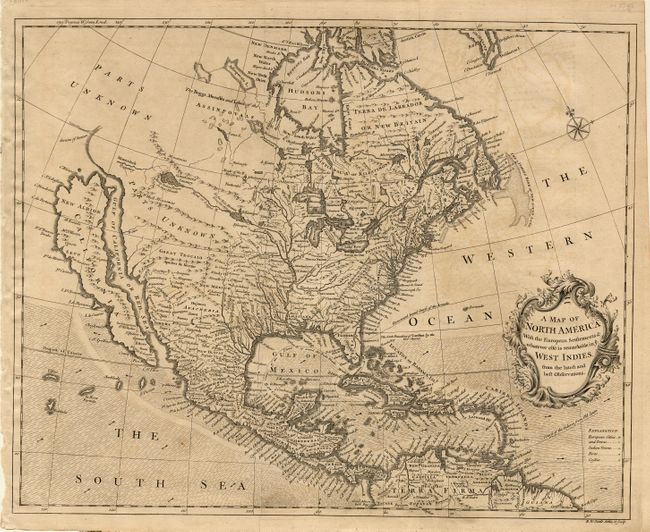
Subject: North America

Period: 1745 (circa)

Publication:

Color: Black & White

Size:
18.5 x 14.9 inches
47 x 37.8 cm
Download High Resolution Image
(or just click on image to launch the Zoom viewer)

Attractive map based on Popple's seminal map of 1733. It is one of the last maps to show the island of California although Seale incorporated some information from Kino in the Southwest. He also continued to portray fanciful details from Baron Lahontan's romantic tale of his 1688-90 travels west of the upper Mississippi River with the Longue River stretching to the Rocky Mountains. Notes the Straits of Anian, but most of the northwest is marked Parts Unknown and contains little data. Shading designates the trade winds with directional arrows showing the course of the winds. The routes of the Spanish galleons are marked in the Caribbean. Includes an ornate title cartouche and compass rose.

References:

Condition: A

Bit of very faint offsetting, and one tiny rust spot in paper, else fine.

Estimate: $1,400 - $1,600

Sold for: $1,200

Closed on 12/3/2003

Archived