Subject: Western Hemisphere
Period: 1740 (circa)
Publication:
Color: Hand Color
Size:
22.5 x 19 inches
57.2 x 48.3 cm
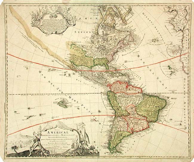
A revision of the elder Homann's 1710 map of the Americas. After his death in 1724, his son (Johann Christoph Homann) re-engraved the plate to correct the western coastline of North America. California is no longer shown as an island, although the remnants of the interior sea can be seen near the Pais de Moozemleck. Good detail near the Great Lakes, which were actively being explored by French fur traders and Hudson's Bay Company. Two large pictorial cartouches (uncolored, as issued) and two small compass roses.
Presumably, the younger Homann's re-engraved plate became damaged, as a third plate was engraved, which is easily identifiable by the eastern coast of Spain appearing in the third plate. Nearly all other details are identical in the third plate, although a few place names are missing, such as Taos, and fewer mountains and forests are illustrated. This example is the third plate.
References:
Condition: B
Nice impression with original color. Margins well worn with a couple of large stains, one just touching border at top. Tissue repair of separation on bottom fold.