Subject: Western Hemisphere
Period: 1719 (circa)
Publication:
Color: Hand Color
Size:
22 x 19 inches
55.9 x 48.3 cm
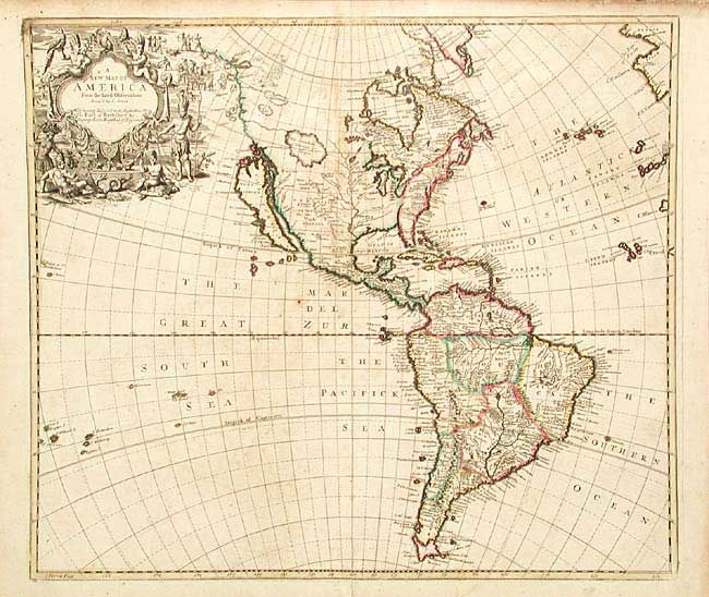
Fine map of the Americas with the Island of California shown with an indented northern coastline. Senex's depiction of the northwestern part of North America is most unusual with the coastline continuing far to the north of California and delineated with two lakes (L. Aquinanbock and L. of Isles), place names (Desolation and Zapezipin) and several offshore islands. The western interior is filled with a huge lake labeled The Great Lake of Thoago or Thoya, from which two rivers flow to the Pacific. The Mississippi River basin is based on Coronelli. The cartography in South America is more typical with the mythical Parime L and enlarged Rio de Plata. The large title cartouche is decorated with natives, parrots, turtles, serpents and scenes of battle and cannibalism. The map is dedicated to the Earl of Berkshire, Deputy Earl Marshal of England.
References: McLaughlin #193; Tooley (Amer) #81, p.130; Wagner #520.
Condition: B
Sharp impression and original color. Margins soiled at edges, well away from map. Light foxing in map. Small tear at top just entering border, repaired with archival tape. Bottom fold separation repaired with archival tape.