Catalog Archive
Auction 105, Lot 612

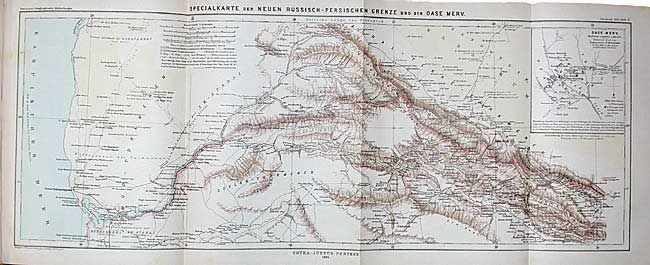
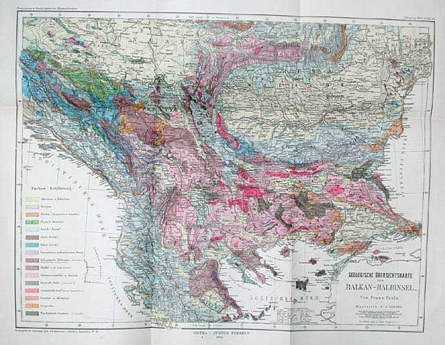
"Mittheilungen aus Justus Perthes' Geographischer Anstatlt.", Petermann, Augustus Herman

Subject: Atlases

Period: 1882 (published)

Publication:

Color: Printed Color

Size:
9.5 x 11 inches
24.1 x 27.9 cm
Download High Resolution Image
(or just click on image to launch the Zoom viewer)

Volume 28 for the year 1882, published by Justus Perthes. Contains over 20 maps, all present per listing. Includes some unusual maps such as, "Geological Map of West Africa, "Wrangel Land" (polar map), "Iwashiro Prefecture Japan", "Russian - Turkish border in Armenia" and a stunning large folding map "Viti oder Fiji Inseln." Plus many others, most larger folding maps. Library binding in black cloth.

References:

Condition: A

Maps and contents very good to fine. Binding shelf worn with tape remnant on spine.

Estimate: $120 - $150

Sold for: $65

Closed on 12/3/2003

Archived