Subject: North Pacific, Alaska and Pacific Northwest
Period: 1776 (published)
Publication: Atlas Universel…
Color: Hand Color
Size:
24.7 x 18 inches
62.7 x 45.7 cm
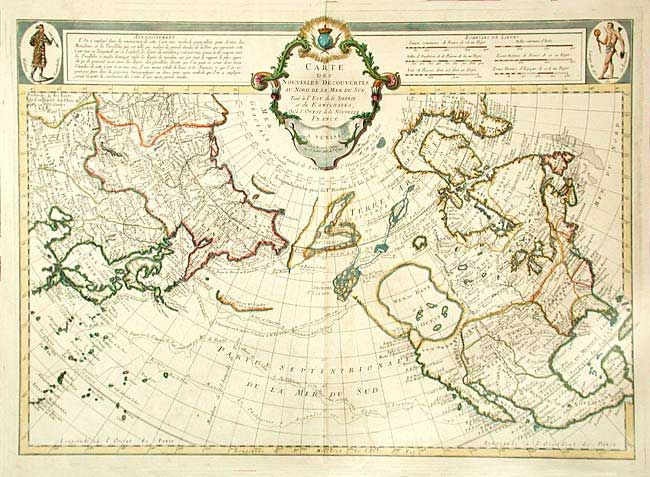
This is the authorized Venice edition of this cornerstone map of Alaska and the Pacific Northwest by Delisle/Buache. It depicts the discoveries of the Russians in 1723, 1732 and 1741, the tracks of Bering's first and second voyages, Joseph Nicolas Delisle's voyage with Capt. Tchirikow in 1741, the track of De Frondat's voyage of 1709, and the route of the Galleons in 1743. The west coast of North America is entirely fictitious north of Cap Blanc with an enormous Sea of the West, Lac Valasco, and Isle of Bernarda. A network of rivers and lakes making up most of a Northwest Passage is derived from the apocryphal voyages of the Spanish admiral Bartholome de Fonte. Title in rococo cartouche flanked by a native of Kamchatka in upper left corner, a native of Louisiana in upper right corner.
References: Falk #1752-7; Hayes #41; Tooley (Am) p.34, #101; Wagner (NW) #566.
Condition: A
Dark and early impression on thick paper. Tiny and insignificant wormhole in centerfold of map, a few light spots.