Subject: Western North America and Eastern Asia
Period: 1772 (published)
Publication: Diderot's Encyclopedie (Supplement)
Color: Hand Color
Size:
14.8 x 11.7 inches
37.6 x 29.7 cm
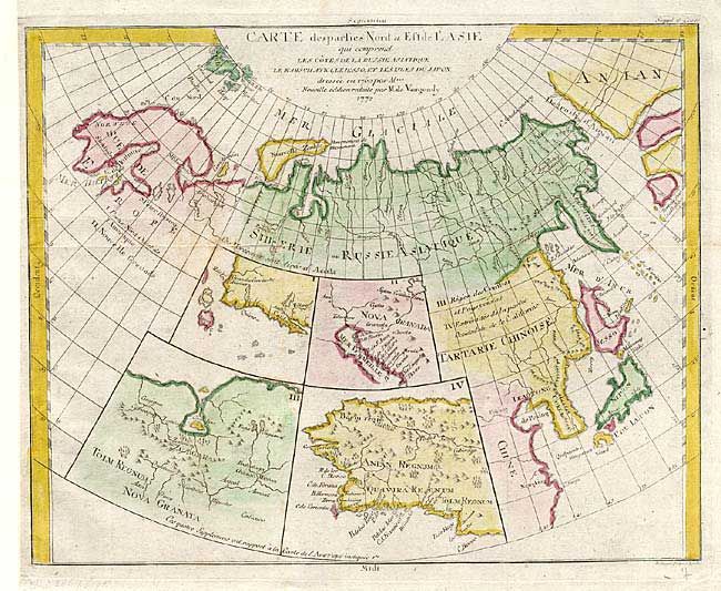
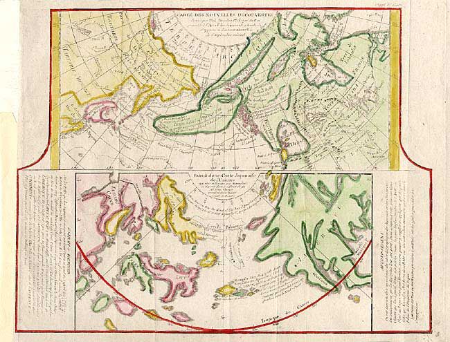
Pair of interesting maps that Didier Robert de Vaugondy made for the Supplement to illustrate the various cartographic theories of the region. First map focuses on the northern coastline of Russia (including Finland), the eastern coast of Asia to just below Nanking, and a bit of the coast of America called Anian. Inset into the map are four small maps of the western part of America: "Nova Granada" showing the Mexican coast of the Gulf of California, "Anian Regnum" that includes Quivira, Tolm, and Zubgara with the seven cities of Cibola, and another untitled inset showing the entire western coast with Japan laying a short distance offshore. The second sheet contains two maps within a single border. Each covers the north Pacific, including the continents bordering it. The top map depicts the theories of Philip Buache concerning the Northwest Passage, with numerous possible routes through North America, including Lace de Valasco, Lac de Fonte and Mer de l' Ouest. Alaska is shown as an elongated island. In Asia Kamchatka is fairly well formed, but Japan is still quite misshapen. The bottom chart depicts the region per Kaempfer, with Japan nicely detailed, but the coasts of both Asia and North America are very deformed.
References: Pedley #406 & 452.
Condition: B
Issued folding, now pressed. First with a couple of unobtrusive spots. Second map with margin added to accommodate framing.