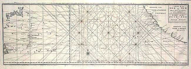
Subject: Pacific Ocean
Period: 1765 (circa)
Publication:
Color: Black & White
Size:
34.5 x 11.4 inches
87.6 x 29 cm
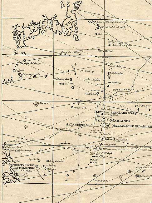
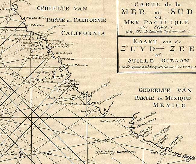
Unusual chart detailing the route of Spanish galleons between the Philippines and Acapulco. The tracks of British Navy Commodore George Anson and Spanish Nostra Seigniora de Cabadonga are shown. Anson captured this galleon, which was loaded with treasure and two important maps that detailed the route Manila galleons had followed across the Pacific for almost two hundred years. This capture enabled the British to disrupt this vital Spanish commerce. Good detail of the Pacific islands. From a Dutch edition of Anson's Voyage around the World with additional title in Dutch.
References: Mercator's World Nov/Dec '98 p. 44.
Condition: A
Issued folded, now pressed. Tiny paper flaw else very fine.