Catalog Archive
Auction 105, Lot 469

"Geographische beschryvinge van t' Beloofde-Landt Canaan…", Visscher, Claes Janszoon
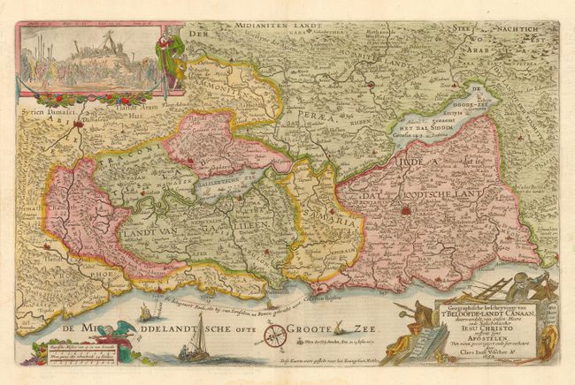
Subject: Holy Land

Period: 1650 (dated)

Publication:

Color: Hand Color

Size:
18.8 x 11.8 inches
47.8 x 30 cm
Download High Resolution Image
(or just click on image to launch the Zoom viewer)

Fine Bible map of the Holy Land with north oriented to the left. This is the elder Visscher's map of Canaan richly engraved and decorated with a vignette of the crucifixion at upper left and the decorative title cartouche incorporating an old fisherman (the mark of Visscher). The sea is filled with fishing boats, the track of Apostle Paul's journey to Rome, a compass rose and an angel embellishes the scale of miles. Dutch text on verso.

References: Laor #789; Poortman & Augusteijn #88.

Condition: A

Faint damp stain in blank margins, well away from image.

Estimate: $350 - $425

Unsold

Closed on 12/3/2003

Archived