Catalog Archive
Auction 105, Lot 372

"Nouvelle Carte des Dix-Sept Provinces des Pays-Bas", Chatelain, Henry Abraham

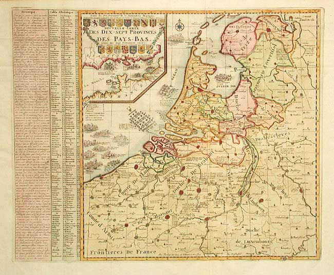
Subject: Belgium and The Netherlands

Period: 1715 (circa)

Publication: Atlas Historique

Color: Hand Color

Size:
17.4 x 18 inches
44.2 x 45.7 cm
Download High Resolution Image
(or just click on image to launch the Zoom viewer)

Fascinating chart of the Low Countries depicting the various battles, both land and sea, between the late 1500's to the early 1700's. All the major fortified cities are graphically depicted with notations of battle dates. Large inset of the English Channel features more sea battles and the cartouche containing the arms of the provinces. A splendid chart providing a synopsis of history.

References:

Condition: A+

Estimate: $400 - $450

Sold for: $300

Closed on 12/3/2003

Archived