Subject: Britain
Period: 1595 (dated)
Publication:
Color: Hand Color
Size:
20 x 14.4 inches
50.8 x 36.6 cm
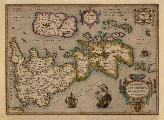
Fine map of Roman Britain based on information from Mercator's 1564 map of the British Isles, improved by a new outline from Saxton's 1579 map and ancient knowledge from Diodorus, Siculus, Plinius, Appianus, Tacitus, Cæsar and Strabo. The map is filled with ancient place names, Hadrian's Wall, and Wall of Pius (mislabeled Severi Imp. Murus). Latin text on verso, published in 1619.
References: Shirley (BI) #186, plt. 71; Van den Broecke #192.
Condition: A
Fine original color with green oxidized. Professionally remargined at top and sides with neatline in excellent facsimile at left and backed with light Japanese tissue.