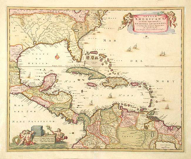
Subject: Gulf of Mexico and Caribbean
Period: 1650-80 (circa)
Publication:
Color: Hand Color
Size:
22 x 18 inches
55.9 x 45.7 cm
Decorative map of the Caribbean covering the region from the Chesapeake through the Gulf of Mexico, with Central America and the northern part of South America. Two superb cartouches with cherubs and mermaids decorate opposite corners. Eight ships sail the seas and three native canoes are depicted off the coast of North America. A number of interesting cartographic myths appear on the map, including two large nonexistent lakes in the region of western Georgia, a non-existent mountain range extending from the Piedmonts right across the continent, and the archetypal cartographic myth, El Dorado, located on Lacus Parime in Guyana.
References: Portinaro & Knirsch #82.
Condition: A
Good impression and original coloring. Some professional repairs on upper and lower centerfold on verso.