Catalog Archive
Auction 105, Lot 242
"Pas-kaart van de Golff de Guanaios Met 't Canaal Tusschen Yucatan en I. Cuba…", Keulen, Johannes van
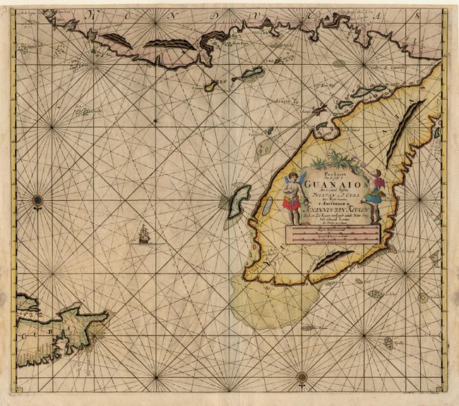
Subject: Mexico and Caribbean
Period: 1684 (circa)
Publication: De Niewe Groot Lichtende Zee-Fakkel
Color: Hand Color
Size:
23 x 20.2 inches
58.4 x 51.3 cm
Download High Resolution Image
(or just click on image to launch the Zoom viewer)
(or just click on image to launch the Zoom viewer)