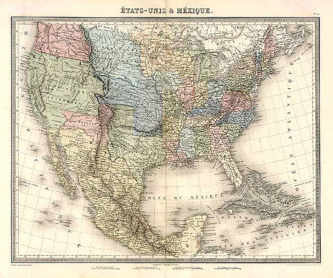
Subject: United States & Mexico
Period: 1848 (published)
Publication: Atlas Universel Geographie
Color: Hand Color
Size:
16.7 x 13.2 inches
42.4 x 33.5 cm
Beautifully engraved and detailed map showing the newly acquired land in the west. Large Northwest Territory, Indian Territory and Oregon Territory (extending into Canada). Most of the west is labeled Nouvelle California with a pre-Gadsden border and Texas appears with an early shape. Remarkable detail throughout includes Indian names, watershed, railroads, forts, roads, etc. A very nice map that shows a transitional period between the Mexican War and the eventual settlement of the northern boundary dispute between the U.S. and England.
References: Phillips (A) #786.
Condition: A+
Beautiful impression and good coloring with full margins.