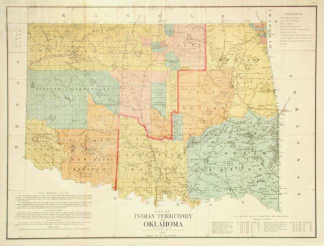
Subject: Oklahoma
Period: 1890 (dated)
Publication:
Color: Printed Color
Size:
29.5 x 22.2 inches
74.9 x 56.4 cm
Large, colorful and historically significant map of the two territories. Oklahoma Territory was created in 1889 and this is possible the only General Land Office map showing the two territories together. Marginal notes give historical information on the various Indian Lands. Another lists 13 railroads authorized by Congress. Both territories would clamor for admission to statehood. The Dawes Commission would soon extinguish Indian land titles that led to eventual statehood for the Oklahoma territory. Documentary back up for the Indian titles are noted in each of the tribal areas.
References:
Condition: A
Issued folding, now backed with archival tissue. Tear at binding side that extends into border, closed on verso, still very good.