Catalog Archive
Auction 105, Lot 182

"A New Map of Indiana with its Roads & Distances", Thomas, Cowperthwait & Co.
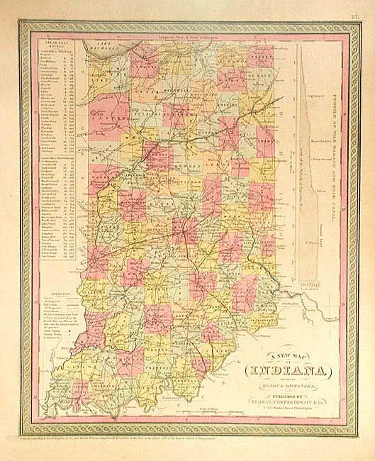
Subject: Indiana

Period: 1853 (published)

Publication: Mitchell's New Universal Atlas

Color: Hand Color

Size:
11.5 x 14 inches
29.2 x 35.6 cm
Download High Resolution Image
(or just click on image to launch the Zoom viewer)

Attractive state map with good detail throughout locating numerous towns and villages, railroads, canals and rivers. Clearly shows the National Road cutting across the middle of the state. Table gives the steamboat routes from Louisville to Pittsburgh and from Louisville to New Orleans. Profile of the Wabash and Erie Canal. Decorative scroll border.

References:

Condition: A

Pleasant ivory toning with one small spot.

Estimate: $120 - $150

Sold for: $60

Closed on 12/3/2003

Archived