Subject: Hawaii
Period: 1797 (circa)
Publication: Atlas du Voyage de la Perouse
Color: Hand Color
Size:
27 x 19.5 inches
68.6 x 49.5 cm
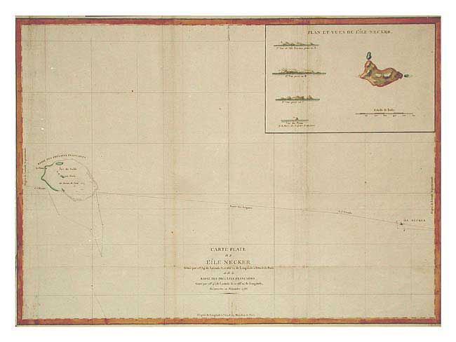
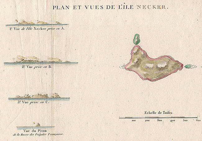
Sea chart of the Pacific Ocean depicting La Perouse's route between Necker Island, a northern island in the Hawaiian Group, to French Frigate Shoal. La Perouse discovered Necker Island on November 4, 1786. This famous French navigator sailed within a third of a league of the island on his passage westward, noting the perpendicular cliffs, white with the droppings of birds, the absence of trees, and the violence of the sea, which made it impossible to land. He called it Ile Necker, in honor of Monsieur Jacques Necker, French Minister of Finance under Louis XVI. Includes a large inset: Plan et Vues de l'Ile Necker.
References:
Condition: B
Trimmed nearly to neatline at sides. A few light spots and creases.