Subject: San Francisco
Period: 1853 &59 (dated)
Publication:
Color: Black & White
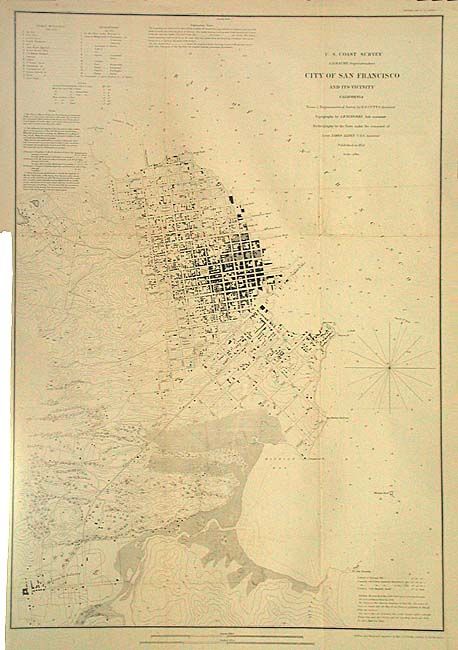
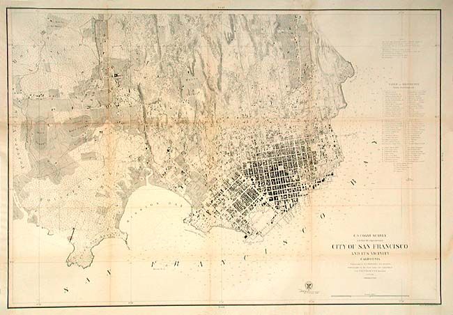
A terrific set of city plans with the same title that makes an interesting study of the city's early growth. Both are fine plans with much detail including buildings, streets and roads, contour lines, etc. Tables list numerous public buildings, reservoirs, etc. The first map (17.7 x 25.5"), 1853, covers the region from North Point to Mission de Delores and to Point San Quentin. Extant buildings are shown in black along the streets in both San Francisco and Mission de Dolores, which are connected by a plank road. The second map (34.7 x 23.5") 1859, is the larger and highly detailed version drawn on a scale of 6" per mile, showing hundreds of individual houses and buildings. Table names and locates over 70 public buildings, numerous wharves and piers, etc. Map extends west to show the Union and Pioneers race courses, the Mission de Dolores and Rancho de San Miguel.
References:
Condition: B
Both issued folding and now backed with archival tissue. Former is very good, latter has a little toning along folds, otherwise very good.