Subject: California
Period: 1848 (published)
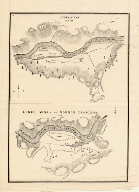
Publication: Positions of the Upper and Lower Gold Mines...July 20th, 1848
Color: Black & White
Size:
6.4 x 9 inches
16.3 x 22.9 cm
One of the earliest printed maps to actually name and locate gold discoveries in California. Gold was first discovered in January 1848 and Sutter tried in vain to keep the discovery quiet. In July, Col. Mason, the Military Governor of California, toured the diggings and sent a report to the President officially announcing the discovery of gold. These maps were a part of this important report, and spawned the great California Gold Rush. The Upper Mines are along the South Fork of the American River and shows where James Marshall first found gold. The lower map depicts numerous tents surrounding a store with a large area of the bar marked GOLD. Lt. William T. Sherman, of later Civil War fame, drew the maps when he was adjutant to the military governor.
References: Wheat (Gold) #52.
Condition: A+
A fine example with dark impression.