Subject: Southwestern United States
Period: 1886 (dated)
Publication:
Color: Black & White
Size:
28.8 x 25.2 inches
73.2 x 64 cm
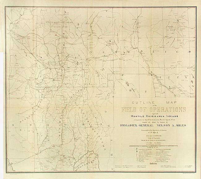
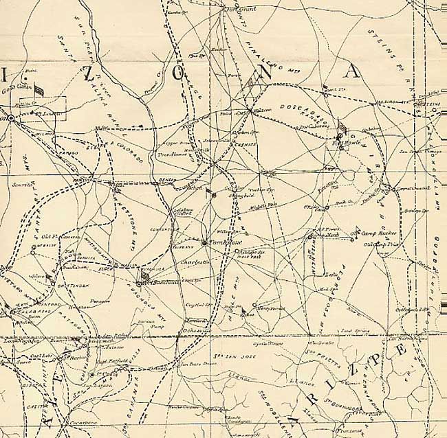
Compiled and Drawn by direction of Brigadier General Nelson A. Miles, commanding the Department of Arizona. By the summer of 1874 Gen. Crook was considered to have largely pacified the Apache. Shortly thereafter, following the death of Cochise, trouble again broke out (mostly with the Chiricahua) in Arizona and New Mexico and continued sporadically for the next ten years under the leadership of Geronimo. In 1886 Gen. Miles replaced Crook and initiated a military campaign against the Apache. Eventually Geronimo was forced to surrender. Those that could be rounded up, including the Apache scouts who served Miles so well, were packed off to Florida as prisoners. This map shows, in considerable detail, Indian fights, military posts, heliograph stations, railroads, wagon roads, and much more. An important map in the history of the Southwest and Apache country.
References:
Condition: A
Issued folding, now backed with archival tissue. Trace of toning along one fold.