Subject: Southwestern United States
Period: 1861 (circa)
Publication: Illustrated Atlas
Color: Hand Color
Size:
24 x 16.8 inches
61 x 42.7 cm
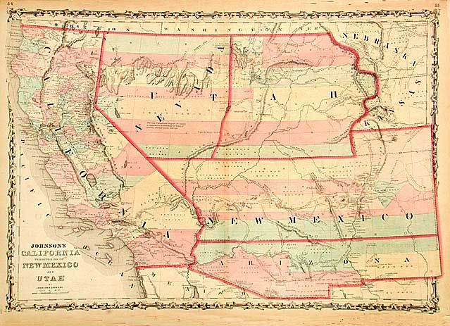
A nice example of this early map from Johnson's Southwest series. The Confederate Territory of Arizona appears in the southern third of New Mexico Territory along with the "Gadsden Ten Million Purchase of Mexico." Nevada Territory makes an early appearance with its boundary with Utah beginning near the Great Salt Lake but wandering south-southwest from Lake Sevier. Filled with historical notes and notations including one note near Quartzite, Arizona referring to the area as being "fertile and abundantly timbered and well watered." Details the Emigrant Road, the Hastings Road, and the routes of numerous explorers and military expeditions. The Gold Region of present-day Colorado is prominently shown in what was then Kansas.
References: Wheat: [TMW] #1027.
Condition: B
Short splits on centerfold just entering map. The one at top includes a small 'V' shaped paper loss that affects a tiny part of the engraved border.