Subject: Utah and Wyoming
Period: 1857 (published)
Publication: Senate Doc. 11, 35th Cong. 1st Sess.
Color: Black & White
Size:
21.6 x 17.5 inches
54.9 x 44.5 cm
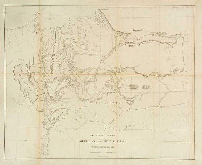
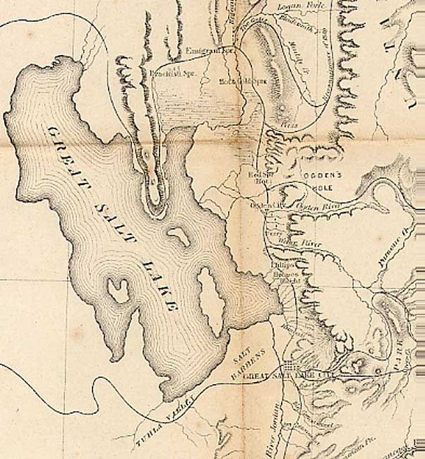
Notable map of the region and emigrant routes into Salt Lake City. South Pass was the famous gateway through the central Rocky Mountains. Marked on the map are lines showing routes practicable for wagons and the routes of earlier exploring parties. The pass was first seen by white men in 1812 but remained largely unknown until disclosed by Crow Indians to Jedidiah Smith. After 1832 it became the principle route for immigrants heading further west. Shows the Mormon communities from just below Nephi to Ogden and as far north as Fort Hall, Idaho. Stansbury's route of 1850 is traced and labeled.
References: Wheat (TMW) 958.
Condition: B
Issued folding, now backed with archival tissue. Toned along a couple folds and a little scattered foxing.