Catalog Archive
Auction 105, Lot 151
"[Lot of 2] Map showing the location of the Indian Tribes within the United States [together with] Map of the Indian Colonies West of Missouri and Arkansas", Eastman, Seth (Capt)
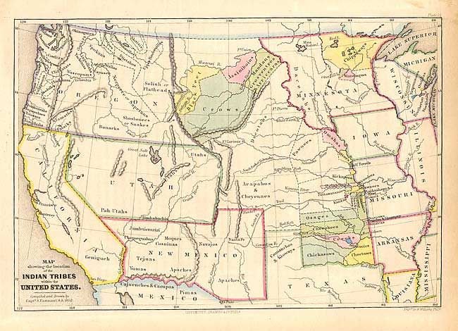
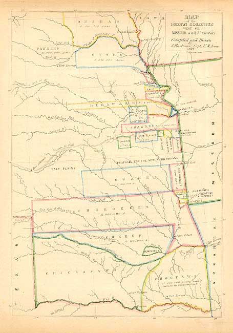
Subject: Western United States
Period: 1852-53 (dated)
Publication: Schoolcraft's Information Respecting the History... Indian Tribes…
Color: Hand Color
Size:
11 x 7.5 inches
27.9 x 19.1 cm
Download High Resolution Image
(or just click on image to launch the Zoom viewer)
(or just click on image to launch the Zoom viewer)