Subject: Western United States
Period: 1849 (dated)
Publication:
Color: Black & White
Size:
18.2 x 11 inches
46.2 x 27.9 cm
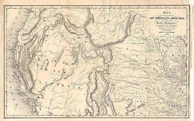
This interesting map is based on Fremont's map of the same period. The region west of the Mississippi to the Pacific Ocean is delineated with the new gold region of California and a notation of Sutter's Fort. The expedition route described is that of Captain Benjamin Bonneville who explored the American West from 1832-1836. The expedition party traveled parallel to the course of the Snake and the Columbia rivers, going as far as Fort Walla Walla before turning back. Fremont's route through California is shown, as well as Kearny's route along the Gila River. Published by J.H. Colton, 86 Cedar St., New York.
References: Wagner-Camp #67:14.
Condition: B
Good impression. Small tear with old repair on right side just into map, and a small hole, both closed with tissue repair on verso.