Catalog Archive
Auction 105, Lot 147

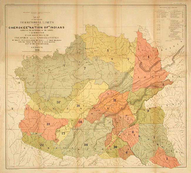
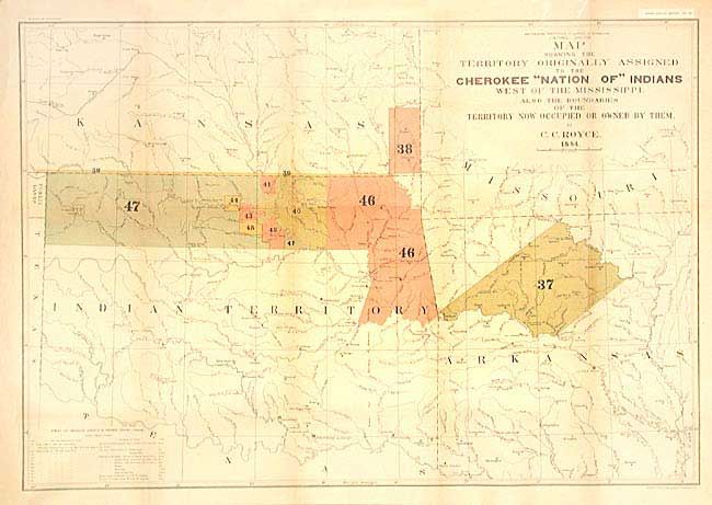
"[Pair] Map of the Former Territorial Limits of the Cherokee Nation of Indians [together with] Map Showing the Territory Originally Assigned to the Cherokee Nation of Indians West of the Mississippi…", Royce, C. C.

Subject: United States - Central & Oklahoma

Period: 1884 (dated)

Publication: 5th Annual Report Bureau of Ethnology

Color: Printed Color

Size:
See Description
Download High Resolution Image
(or just click on image to launch the Zoom viewer)

Pair of large maps depicting, in a colored and numeric key, those lands owned and ceded by the Cherokee Indians. First map (31.2 x 28.3") shows the former territorial limits of the Cherokee Nation between the Ohio and Tennessee rivers and the Appalachian Mountains. It depicts the various cessions made by them to the colonies of the United State up to their removal to west of the Mississippi. The second map (30 x 20.7") shows the regions assigned to them in Indian Territory. The map also includes a small section of Public Lands, Kansas and Arkansas. Shows many villages, forts and Indian Agencies. Inset gives chronological detail of Cherokee treaties. A great pair of large maps portraying an important period in Native American history.

References:

Condition: A

Both backed with archival tissue. Reparied tear on former just into title. Both lightly toned along some folds, still very good.

Estimate: $350 - $450

Sold for: $250

Closed on 12/3/2003

Archived