Catalog Archive
Auction 105, Lot 144

"Carte Detaillee de la Basse-Louisiane et Floride Occidentale…", Blondeau, Alexandre

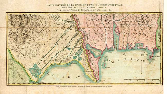
Subject: Southern United States

Period: 1803 (circa)

Publication: Vue de la Colonie Espagnole du Mississipi…

Color: Hand Color

Size:
16.2 x 7.6 inches
41.1 x 19.3 cm
Download High Resolution Image
(or just click on image to launch the Zoom viewer)

A very uncommon map of the Gulf coast extending from Texas and the Rio Grande (Riviere de San Marco ou de Colorado) to West Florida at the Rio des Apalaches. Nicely engraved to show topography, Indian villages and rivers. Settlements are shown at Baton Rouge, New Orleans, Plaquemine, Mobile, and Pensacola.

References:

Condition: B

Issued folding. Some scattered foxing and trimmed close at binding side with an old repaired tear entering map about 1 inch.

Estimate: $250 - $300

Sold for: $750

Closed on 12/3/2003

Archived