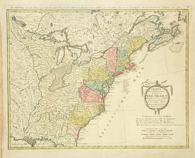
Subject: Eastern United States
Period: 1784 (dated)
Publication:
Color: Hand Color
Size:
22.7 x 17.5 inches
57.7 x 44.5 cm
Fine large map of the newly formed United States of America. The southern states are shown with their western boundaries on the Mississippi River, although the coloring shows only regions east of the Appalachians as being organized. As with many German maps of the period, there are some incorrect state boundaries. A list of the principal German communities in New Jersey and Pennsylvania are listed. The interior regions are shown with considerable topographical detail, locating numerous Indian tribes. The uncolored title cartouche is garland draped with a hat and crossed swords. A French title is engraved outside top neatline.
References: McCorkle #784-7; Sellers & Van Ee #757.
Condition: A+
No centerfold as map was bound at side. A few worm holes in blank margins, else very fine.