Catalog Archive
Auction 105, Lot 134

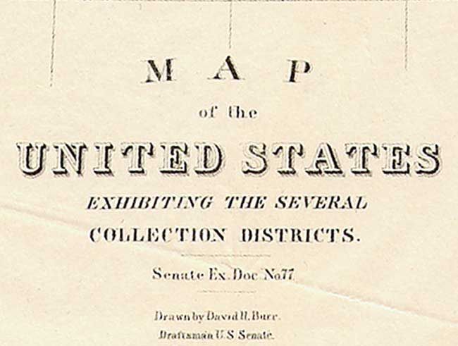
"Map of the United States Exhibiting the Several Collection Districts", Burr, David H.

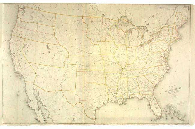
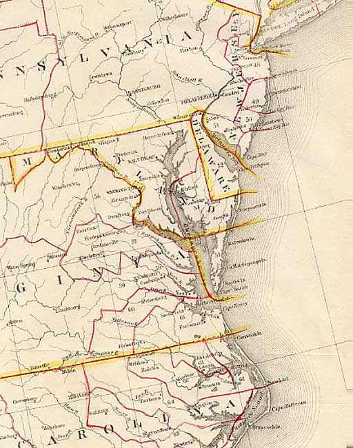
Subject: United States

Period: 1856 (published)

Publication:

Color: Black & White

Size:
48.5 x 38.5 inches
123.2 x 97.8 cm
Download High Resolution Image
(or just click on image to launch the Zoom viewer)

A relatively scarce and most interesting map with red lines indicating the district boundaries and yellow lines distinguishing the states and territories. Arizona and New Mexico are shown as one territory, Nebraska includes the present states of the Dakotas and Wyoming, West Virginia has not separated from Virginia, Utah spans from California to Kansas, and Washington and Oregon extend to the continental divide. Indian Territory is unnamed. Burr was 'Geographer and Draftsman to the Senate' between 1855-59.

References:

Condition: A

Issued folding, now backed with archival tissue. Edges a little rough.

Estimate: $250 - $350

Sold for: $375

Closed on 12/3/2003

Archived