Catalog Archive
Auction 105, Lot 130

"Map of the Country from Lake Superior to the Pacific Ocean. From the latest Explorations and Surveys to accompany the Report of Edwin F. Johnson Chf. Engr. Northern Pacific R.R.", Colton, G.W. & C.B.

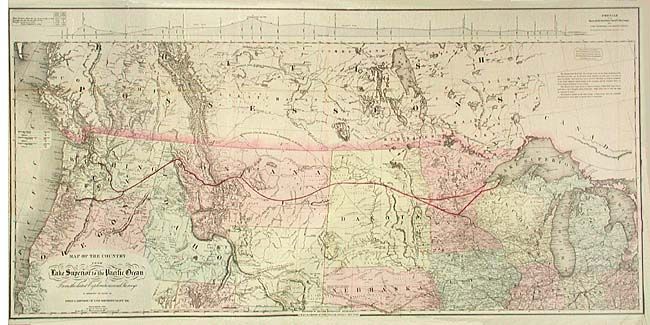
Subject: Western Canada and United States

Period: 1867 (dated)

Publication:

Color: Hand Color

Size:
45 x 21.8 inches
114.3 x 55.4 cm
Download High Resolution Image
(or just click on image to launch the Zoom viewer)

Large and very detailed railroad map covering from Detroit west to the Pacific, well into Canada and south to about the 39th parallel and the Great Salt Lake. Absolutely filled with detail, the Pony Express route, overland mail routes, Fremont's exploration routes and dates, proposed and existing railroads, wagon roads, isothermal lines, forts and much more. At the top is a profile of the Northern Pacific Route. The Northern Pacific had a stormy career enduring recessions, mergers, poor cost controls etc. It was not until 1883 that it actually became a transcontinental railroad. A terrific and scarce map that displays a remarkable amount of detail.

References:

Condition: B

Backed with archival tissue. Toned along one fold and a little wrinkling in the thin paper, else very good.

Estimate: $500 - $600

Sold for: $600

Closed on 12/3/2003

Archived