Subject: Western Canada & United States
Period: 1797 (published)
Publication: Atlas du Voyage de la Perouse
Color: Hand Color
Size:
19.5 x 27 inches
49.5 x 68.6 cm
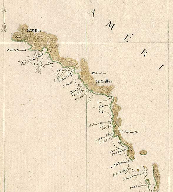
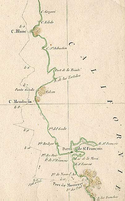
Superb large-scale map of the West Coast from Monterey California to Mount St. Elias in Alaska depicting the route of the voyage with only those parts actually surveyed. Puget Sound is conspicuously missing. Jean-Francois de Galaup, Comte de La Perouse commanded a French scientific expedition to the Pacific in 1785-88. Recognized as one the foremost naval commanders and navigators in France, he was selected by King Louis XVI to complete Captain James Cook's exploration of the western Pacific. La Perouse explored the coasts of the Gulf of Alaska and northwestern North America in search of the fabled Northwest Passage. After leaving America his expedition continued on to Asia where he explored from Kamchatka to Macao and the Solomon Islands in the South Pacific. His expedition vanished shortly after leaving Botany Bay, Australia, in 1788.
References: Falk #1797-8; Wagner (NW)#840.
Condition: A
Folding as issued with a few creases.