Subject: Canada & United States
Period: 1794 (dated)
Publication:
Color: Hand Color
Size:
12 x 18.6 inches
30.5 x 47.2 cm
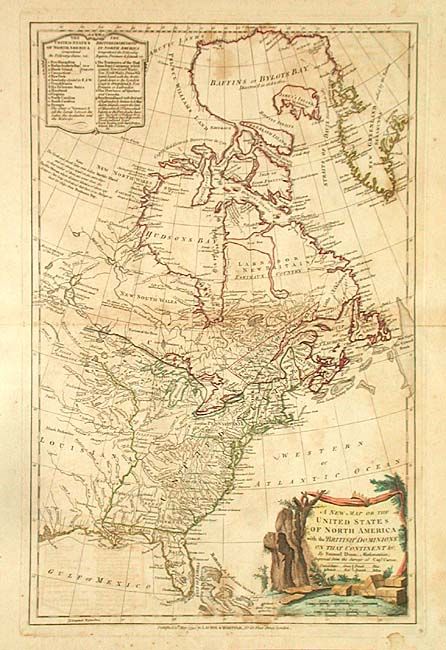
Interesting map of the eastern regions of Canada and the United States. In the United States the boundaries of the states are shown only extending to the Appalachian Mountains with Indian nations occupying the western lands. Table enclosed in a simple cartouche at top lists the 13 states and "The state of Vermont & all the Lands between the Lakes, The Apalaches [sic] and the Missisipi [sic]". An interesting notation in Canada declares that there is no passage to the Pacific from Hudson Bay. Attractive title cartouche. This map, based on the surveys of Captain Carver, was originally drawn in 1774 and updated several times; this being the 1794 edition published by Laurie & Whittle.
References: McCorkle #794.5.
Condition: B
Original color with a color key. Some light foxing and offsetting.