Subject: Colonial South
Period: 1752 (dated)
Publication:
Color: Black & White
Size:
36.5 x 20.2 inches
92.7 x 51.3 cm
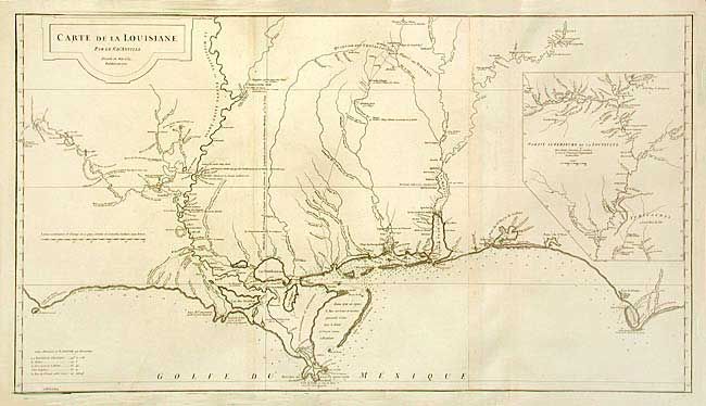
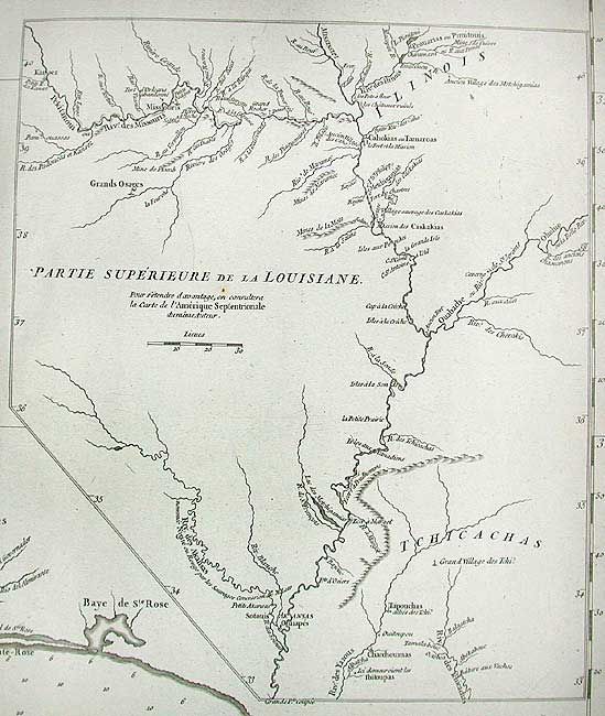
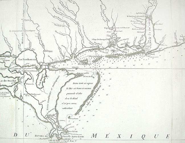
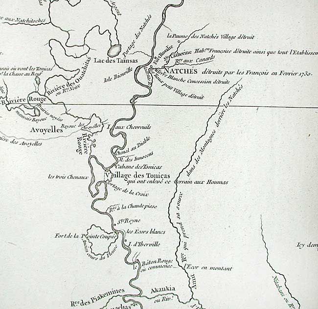
A large and boldly graphic map that extends along the coast from Cabo del Norte in the west to Cabo Escondido, and in the interior from Province de Tecas east to Apalachicola River in Florida. For the period, very fine detail along the coast, particularly in the areas of New Orleans, Pasagoula, Mobile and Mobile Bay, Pensacola Bay (here Baye de Ste. Marie de Galbes), and St. Josephs Bay. Remarkably accurate mapping of the course of the Red, Mississippi, Pearl, Pascagoula, Tombigbee (Riviere des Tchicachas) and Alabama Rivers and tributaries. Numerous notes on Indian villages and forts. Large inset "Partie Superieure de la Louisiane" maps the course of the Mississippi River to it confluence with the Missouri and above.
References: Phillips (A)# 571-35; Lemmon, Magill & Wiese #24.
Condition: A+
Dark impression on thick hand laid paper. Two sheets joined. A couple faint hints of toning, still remarkable condition for a map of this size.