Subject: Colonial New England
Period: 1778 (dated)
Publication:
Color: Hand Color
Size:
22.4 x 27.8 inches
56.9 x 70.6 cm
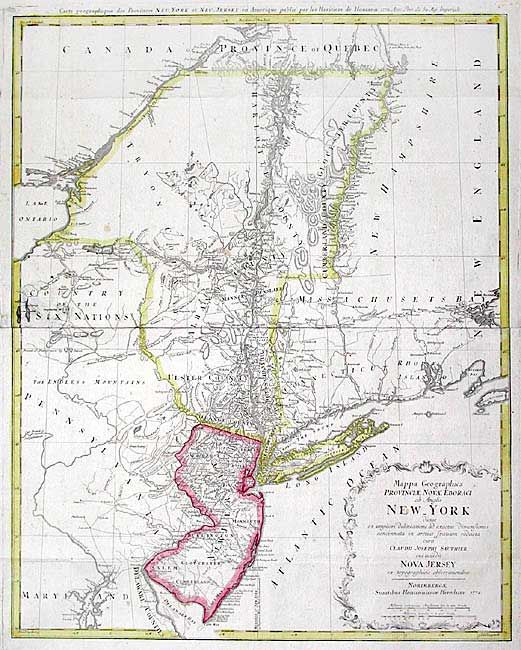
Handsome Revolutionary War period map of the region between Delaware Bay and Boston Harbor, north to include Montreal and west to the Finger Lakes district in New York. Based on the survey of the region by Claude Sauthier compiled between 1771 and 1774, the map provides excellent information including topographical detail, towns, forts, churches, roads, ferries, mills, and taverns. Also shows Dartmouth College and the settlements along the northern part of the Connecticut River. The disputed line of partition between New York and New Jersey are shown, as are boundaries of Pennsylvania with the Six Nations and other early boundaries. Two-sheets joined as issued.
References: McCorkle #778.19; Sellers & Van Ee #1049.
Condition: A
Overall very good with original color. Couple of small spots and an printer's ink smudge at center left.