Subject: Colonial Northeast
Period: 1777 (dated)
Publication: Grosser Atlas
Color: Hand Color
Size:
22.5 x 30 inches
57.2 x 76.2 cm
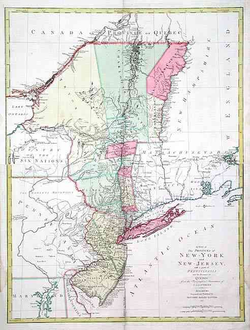
A beautiful Revolutionary War period map of New York and New Jersey with portions of Pennsylvania and Canada. The map details areas crucial to the war's early years, particularly the Hudson Valley and Lake Champlain. It covers from the eastern edge of Lake Ontario up the St. Lawrence to the Connecticut River in the north, and from Chesapeake Bay along the New Jersey shore to Long Island across to Martha's Vineyard in the southern portion of the map. The western part of New York is labeled Country of the Six Nations referring to the Indian nations of the Iroquois Confederacy. One of the nicer features of this large map is the meticulously rendered river systems and towns, particularly the Hudson and Connecticut Rivers. Large counties fill the northern part of New York. A line bisects New Jersey into eastern and western portions. This map is a smaller version re-engraved by Lotter from Claude Joseph Sauthier's larger, folding map of 1776. This issue by Lotter was directed at a German audience, probably because of the high number of German mercenaries fighting with the British army.
References: McCorkle #777.20; Sellers & Van Ee #1048.
Condition: A
Map printed on two joined sheets, slightly offset. Couple of soft printer's creases in map, fold separation in blank margin, lightly closed with archival tape and a couple of small damp stains, also in blank margins.