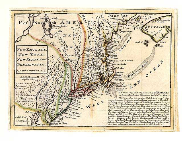
Subject: Colonial New England
Period: 1729 (dated)
Publication: Atlas Minor…
Color: Hand Color
Size:
10.7 x 7.8 inches
27.2 x 19.8 cm
First state of this great early map of New England and one of the earliest Post Road maps. New York is confined to a narrow strip along the Hudson River and New Jersey is divided into East and West New Jersey. A fascinating account of the post routes in the colonies fills part of the map - "The Western Post setts out from Philadelphia every Fryday, leaving letters at Burlington and Pert Amboy and arrives at New York on Sunday night..." Sounds like better service than in the 21st century!
References: McCorkle #729.2.
Condition: B
Slight toning at centerfold. Margins trimmed, but still adequate for framing. Professional repair of a small tear into top neatline.