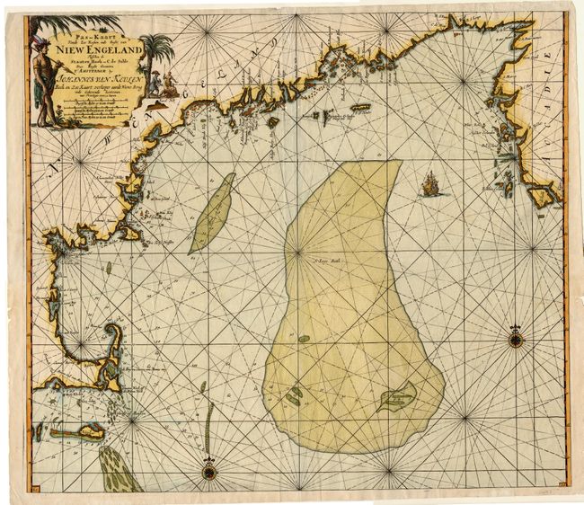
Subject: Colonial New England
Period: 1684 (circa)
Publication: De Niewe Groot Lichtende Zee-Fakkel
Color: Hand Color
Size:
23 x 20.2 inches
58.4 x 51.3 cm
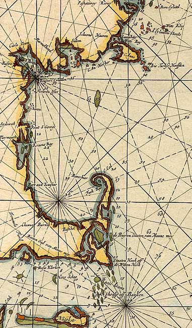
One of the earliest obtainable sea charts of the New England coast from this famous Dutch pilot book, which was produced during the period of Dutch dominance as a mercantile and shipping power. It covers the coast from Nova Scotia to Cape Cod and Nantucket. The rendering of Cape Cod is very detailed for the period, complete with soundings, shoals and navigational hazards. Offshore the chart is dominated by St. George's Bank - one of the prime cod fisheries of the region. It is embellished with rhumb lines, compass roses, a sailing ship and a large title cartouche featuring natives, a Dutch trader and incongruous palm trees.
References: McCorkle #684.2.
Condition: B
Clean and bright with a sharp impression and nice color. Two small wormholes on centerfold, not affecting printed surface. A few chips at paper edges.