Subject: Colonial North America
Period: 1764 (circa)
Publication: Memoires des Commissaires…
Color: Hand Color
Size:
17.4 x 13.5 inches
44.2 x 34.3 cm
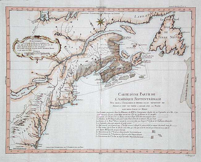
Interesting map covering the eastern seaboard from South Carolina to Labrador with emphasis on the rich fisheries of Acadia. A decorative cartouche contains a notice that the map is based on English sources and deliberately does not show provincial borders or the boundary between the British and French colonies. There is a lengthy notation below the title explaining the various boundary disputes and treaties between France and Britain. The region of Acadia is engraved with various hachuring to designate the regions involved. Engraved by I.P. Dreppe. A translation of the notice is as follows: The boundaries of the English provinces, both between each other and between themselves and Canada, have been taken from English maps, and are here without inference. For the same reason the map has not been marked New France, as it should have been.
References: cf. Kershaw #704.
Condition: B
Issued folded with a tiny separation at one fold intersection. Framer's tape closing some fold separations. Later color