Subject: Western Hemisphere
Period: 1774 (dated)
Publication: Atlas Novus…
Color: Hand Color
Size:
24 x 20 inches
61 x 50.8 cm
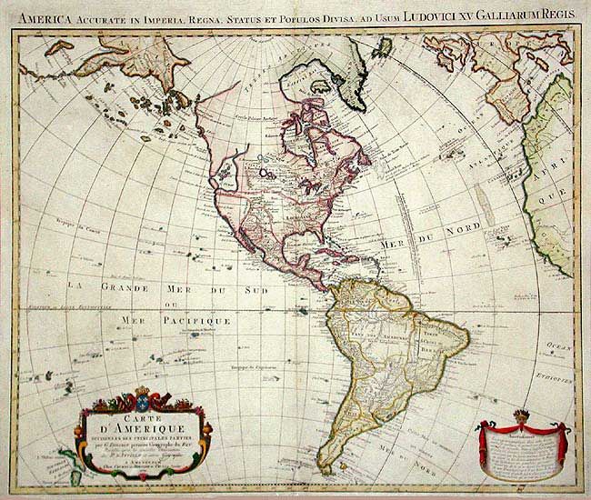
A large and well-engraved later edition with the addition of the Russian discoveries in the Northwest plus some fascinating and erroneous features. A large Mer de l’ Ouest is depicted north of Cap Blanc. A nonexistent series of rivers and lakes stretches west from the Great Lakes, attributed to the Baron Lahontan, an explorer whose study of the native populations proved to be more scientific than his cartography. Tooley notes that improvements and additions have been made to the islands in the Pacific. Decorative cartouche with the Covens and Mortier and Covens Junior imprint.
References: Tooley's (America) p. 17, #20.
Condition: B
Delicate coloring on thick paper with large watermark. A few short marginal tears, repair of centerfold split at bottom, else very good.