Subject: Western Hemisphere
Period: 1627 (circa)
Publication:
Color: Hand Color
Size:
19.6 x 14.9 inches
49.8 x 37.8 cm
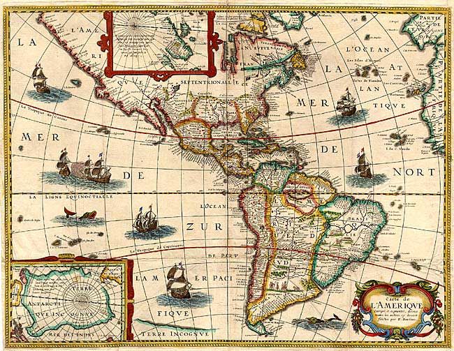
According to Burden, "this rare map is one of a set of the four known continents that Melchior Tavernier had engraved, with or without Petrus Bertius' permission is unclear." Burden attributes Cornelis Danckerts (the elder) as the engraver. The map itself bears only the name P. Bertius and while similar to his map of 1624, this map has a completed western coast of North America and different decorations in the sea. It is based on Jodocus Hondius' map of 1618, with the completion of the southern coast of Tierra del Fuego. The map is richly embellished with two polar insets, a decorative cartouche and numerous ships, sea battles, sea monsters, and scenes of Native American life in South America. Rare first state, without Neuf Amsterdam and other colonial placenames in the Northeast.
References: Burden #218.
Condition: B
Fine impression and color. Several old paper repairs on verso of folds, which would benefit from professional replacement. Top fold separation just entering map, closed with archival tape. Some extraneous creases from misfolding.