Catalog Archive
Auction 104, Lot 575

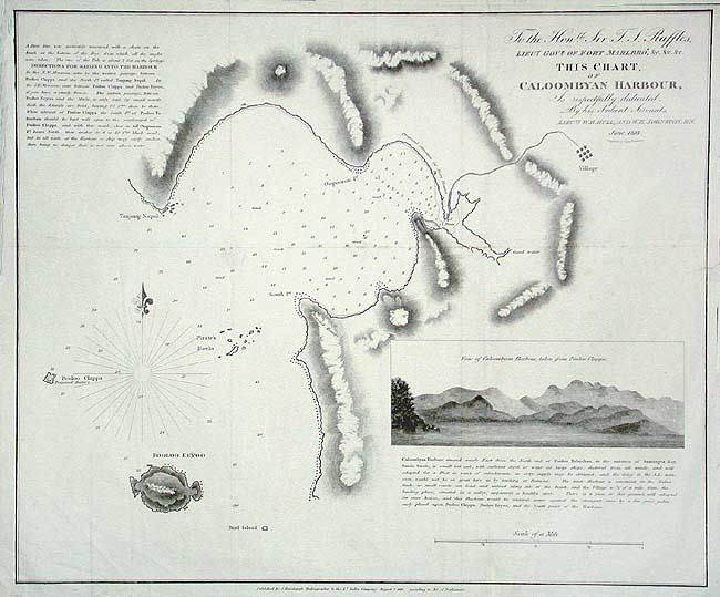
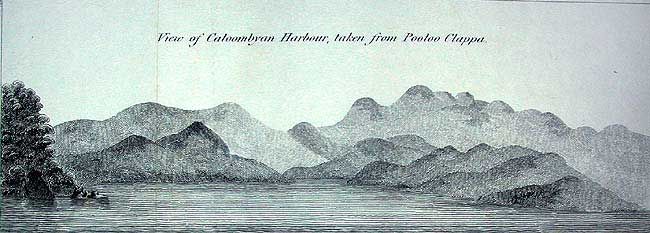
"To the Honble. Sir T.S. Raffles…This Chart of Caloombyan Harbour is respectfully dedicated…", Horsburgh, James (Capt)

Subject: South East Asia

Period: 1819 (dated)

Publication: Atlas of the East Indies

Color: Black & White

Size:
19.4 x 16 inches
49.3 x 40.6 cm
Download High Resolution Image
(or just click on image to launch the Zoom viewer)

A scarce chart by Lieuts. Hull and Johnston that shows a small harbor on the western coast of Malaysia along the Sunda Straits. Names Tanjong Napal and Oogooron Points, and the islands of Pooloo (Pulau) Eeyoo, Pooloo Clappa and the Pirate's Rocks. Inset: View of Caloombyan Harbour, taken from Pooloo Clappa. Locates a village inland, good water, the proposed battery and proposed storehouses. Made during the time Raffles was Lieutenant-Governor of Bencoolen.

References: Phillips (A) 3171.

Condition: B

Some light scattered foxing, intersection fold splits with repairs on verso.

Estimate: $150 - $200

Sold for: $100

Closed on 9/10/2003

Archived