Catalog Archive
Auction 104, Lot 567

"[Lot of 2] Carte de l'Isle de Cheu-Chan ou Isle de Chusan de la Province de Che-Kiang avec les Costes et Isles [with] Carte de la Baye d'Hocsieu et des Entrees de la Riviere de Chang…", Bellin, Jacques Nicolas
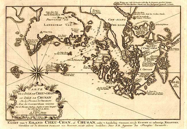
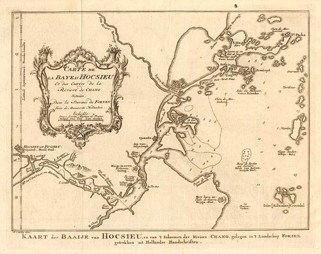
Subject: China

Period: 1759 (circa)

Publication:

Color: Black & White

Size:
12.5 x 8 inches
31.8 x 20.3 cm
Download High Resolution Image
(or just click on image to launch the Zoom viewer)

Pair of detailed coastal maps. First is of the area east of Ningbo in the Chinese province of Chekiang, located across the bay from Shanghai. Compass rose orients the chart with north to the right. Second depicts the mouth of the Chang River in the vicinity of Foochow in the Fokien Province. Both are embellished with a decorative title cartouches. Dutch titles below, engraved by J. van Schley.

References:

Condition: A+

Fine dark impression, toning at paper edges.

Estimate: $150 - $200

Sold for: $110

Closed on 9/10/2003

Archived