Catalog Archive
Auction 104, Lot 472

"Russiae et Novae Zemlae Maritimae", Renard, Louis
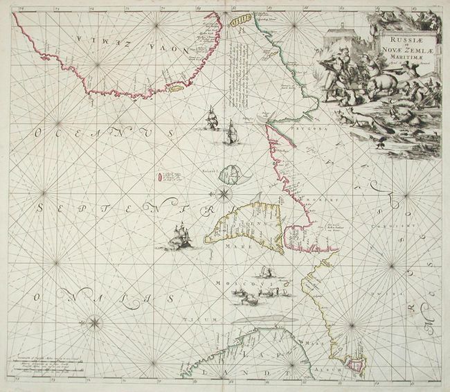
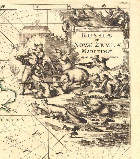
Subject: Russia

Period: 1715 (circa)

Publication: Atlas de la Navigation et du Commerce

Color: Hand Color

Size:
22.2 x 19.3 inches
56.4 x 49 cm
Download High Resolution Image
(or just click on image to launch the Zoom viewer)

Splendid sea chart covering the Barent Sea coast from Finland to Nova Zemla with north oriented to the left by two compass roses. The chart is embellished with sailing ships, whaling scenes and an incredible title cartouche featuring a scene of men fighting bears and sea monsters.

References:

Condition: B

Fine impression and original color. Two short tears just entering map, closed with archival tape.

Estimate: $550 - $650

Sold for: $375

Closed on 9/10/2003

Archived