Subject: Ancient World
Period: 1700 (circa)
Publication: A New Sett of Maps both of Antient and Present Geography
Color: Hand Color
Size:
20.2 x 14.5 inches
51.3 x 36.8 cm
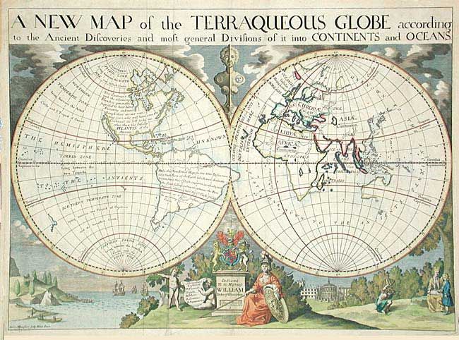
Handsome double hemisphere map showing California as an Island. This is one of a pair of maps Wells included in his atlas - this one depicting the world as known to the ancients. The Old World is shown by hachure and color within the framework of the modern world. North America is noted as perhaps being "no other, than the Insular Atlantis of the Ancients." The map is surrounded by lovely engraved scenes including the royal coat of arms and a dedication to His Highness William, Duke of Gloucester who was attending Oxford where Wells was a teacher of mathematics and geography and who appears with his tutor under the tree on the right. On either side of the dedication are small landscapes, one of ships arriving in the New World and one of the Radcliffe Camera in Oxford. Engraved by Michael Burghers.
References: Shirley #608.
Condition: A
Couple of minor creases, else fine.