Subject: Scandinavia
Period: 1730 (circa)
Publication: World Described
Color: Hand Color
Size:
40 x 24 inches
101.6 x 61 cm
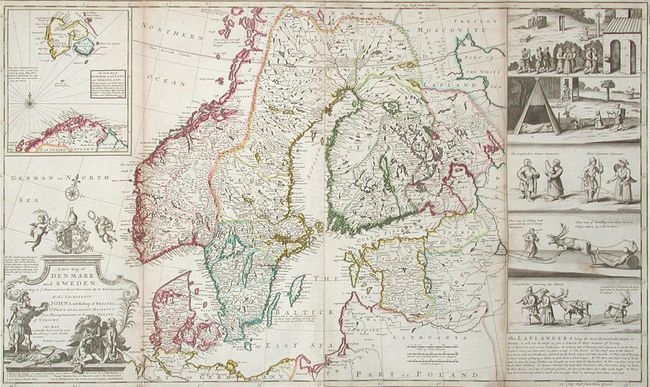
Herman Moll's best-known works are the large maps from this atlas. These maps with well defined boundaries, extensive notations, informative vignettes and distinctive style achieved high acclaim during a period of French dominance in cartography. This map covers Scandinavia in great detail and includes a large inset of the northern coast of Norway and Sptizbergen. At right is a panel of five large views of life among the Laplanders with images of skiing, sledding, reindeer, etc. It is decorated with an impressive title cartouche with a military theme. There are also notes on scientific observations taken in 1694 by "King Charles ye XI, and his Mathematicians." Includes the imprints of Moll, John Bowles, and Philip Overton. Two-sheets joined, as issued. Due to their large size, maps from this atlas are rarely found in fine condition.
References:
Condition: B
Original color. Toned along outside folds with separations partially closed with archival tape. Small loss in blank margins. Overall good, with no major imperfections, printed on high quality heavy paper.