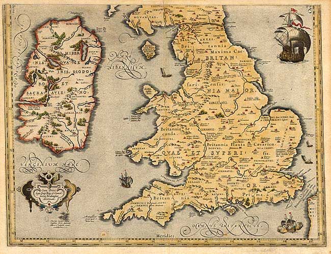
Subject: England, Wales and Ireland
Period: 1592 (published)
Publication: Parergon
Color: Hand Color
Size:
19.2 x 14.5 inches
48.8 x 36.8 cm
This is the bottom sheet of a two-part map. It covers England, Wales and Ireland and combines the modern geographical information of Mercator and Saxton with ancient knowledge from Diodorus, Siculus, Plinius, Appianus, Tacitus, Caesar and Strabo. Probably engraved by Jan Wierix and richly embellished with a large sailing ship, five smaller ships and a strapwork cartouche containing the dedication. The two-part map only appeared in the early editions; being replaced by a single plate in 1595. Only 400 are estimated by Van den Broeck to have been printed.
References: Shirley (BI) #160; Van den Broecke #191.
Condition: B
Couple of minor spots with toned margins.