Catalog Archive
Auction 104, Lot 284
"Plan of the Island of Bequia Laid Down by Actual Survey under the Direction of The Honorable The Commissioners for the Sale of Lands in the Ceded Islands", Wilkinson, Robert
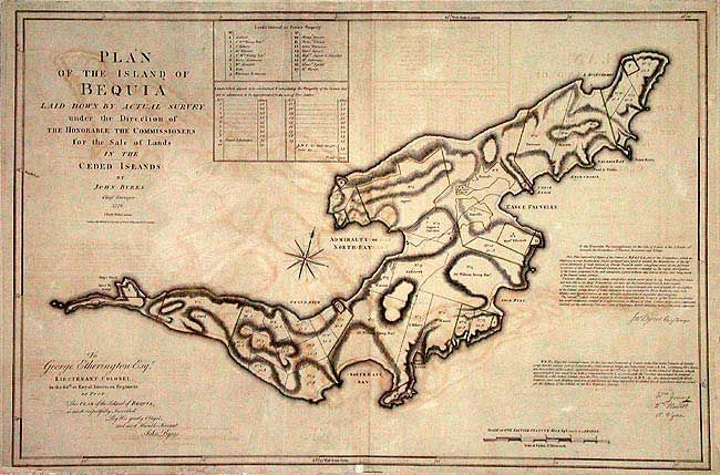
Subject: Lesser Antilles
Period: 1776 (dated)
Publication:
Color: Hand Color
Size:
35.5 x 24.5 inches
90.2 x 62.2 cm
Download High Resolution Image
(or just click on image to launch the Zoom viewer)
(or just click on image to launch the Zoom viewer)