Catalog Archive
Auction 104, Lot 256

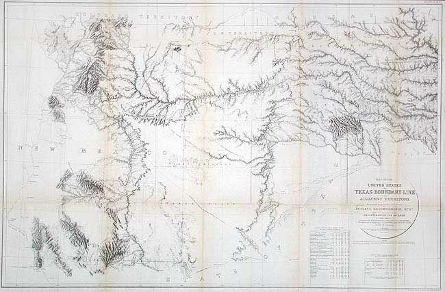
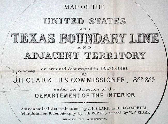
"Map of the United States and Texas Boundary Line and Adjacent Territory determined & surveyed in 1857-8-9-60, by J.H. Clark U.S. Commissioner", U.S. Geological Survey (USGS)

Subject: Texas

Period: 1902 (published)

Publication: US Geological Survey Bulletin 194

Color: Black & White

Size:
40 x 26.3 inches
101.6 x 66.8 cm
Download High Resolution Image
(or just click on image to launch the Zoom viewer)

Large and extremely detailed chart by J.H. Clark, U.S. Commissioner, drawn by J.E. Weyss, circa 1860. The map features the survey lines between Texas and New Mexico with good topographical detail. Locates forts, Raton Pass, the Santa Fe and Albuquerque trails, numerous explorer's routes, and Indian trails. The map is an interesting historical curiosity because it was not published when the survey was finished due to the outbreak of the Civil War. In 1902 it was belatedly included in a Geological Survey Bulletin by Marcus Baker.

References: Wheat [TMW] #1022.

Condition: A

Issued folding, now backed with archival tissue. Light toning along some folds, still very good.

Estimate: $200 - $250

Sold for: $550

Closed on 9/10/2003

Archived