Catalog Archive
Auction 104, Lot 253
"Geological Map of the Route explored by Capt. Jno. Pope…From the Red River to the Rio Grande…", U.S. War Dept.
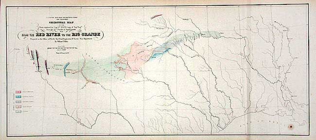
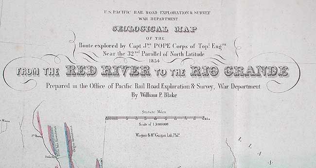
Subject: Texas
Period: 1854 (dated)
Publication: U.S. Pacific Rail Road Exploration Survey
Color: Hand Color
Size:
22.3 x 9.6 inches
56.6 x 24.4 cm
Download High Resolution Image
(or just click on image to launch the Zoom viewer)
(or just click on image to launch the Zoom viewer)