Subject: World
Period: 1658 (circa)
Publication:
Color: Hand Color
Size:
22 x 18.5 inches
55.9 x 47 cm
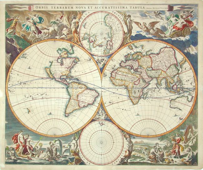
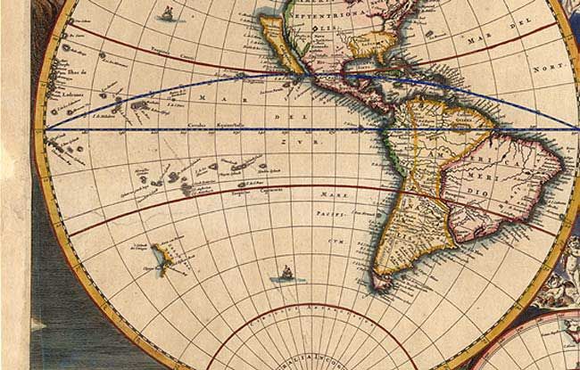
Magnificent large map regarded as the foundation for highly decorative Dutch world maps produced throughout the remainder of the 17th century. The twin hemispheres are surrounded by dramatic scenes drawn by Nicolas Berchem. These superb engravings represent the rape of Persephone, Zeus being carried across the heavens in an eagle-drawn chariot, Poseidon commanding his entourage, and Demeter receiving the fruits of the Earth. Inset between the cusps are smaller polar projections, each flanked by allegorical representations of Fire, Air, Water and Earth. Geographically the map is based on Blaeu's large world map of 1648 with minor variations in the Island of California shown here with a flat northern coast, and Anian appearing adjacent to a strait leading within striking distance of the western shores of Hudson Bay. In China, stippling is used for the first time in a general map to denote a desert, Xamo Desertum, just west of the Great Wall. The map appeared in Jansson's Novus Atlas in 1658 and was used in several later atlases both by Jansson and Visscher, all in this unchanged state.
References: Shirley #406.
Condition: A
Superb original color, lightly age-toned. A couple of very minor professional repairs of marginal tears and one extending across the Pacific Ocean, now nearly invisible.