Subject: United States - Western
Period: 1856 (dated)
Publication: New Universal Atlas
Color: Hand Color
Size:
13 x 16 inches
33 x 40.6 cm
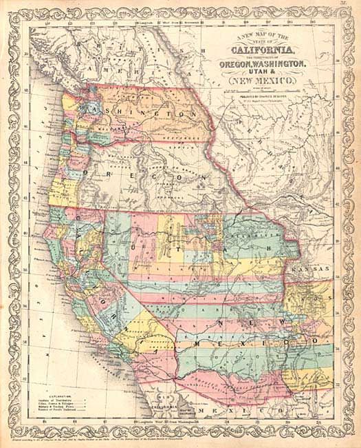
Fine map of California and the large western territories from this important series of maps originating with Samuel Augustus Mitchell. The map is filled with early county configurations, the exploration routes of Lewis and Clark, Fremont, Kearney, and Cooke, and the Spanish and Oregon Trails. Washington and Oregon have their eastern boundaries in the Rocky Mountains and county development is confined west of the Cascades. Utah Territory extends to Middle Park and Long's Peak in present-day Colorado with its eastern border with Nebraska and Kansas. The three vertical counties of Carson, Humboldt and St. Marys form the beginnings of what will become Nevada. The Proposed Arazonia Territory is demarcated between the Gila River and the Gadsden Treaty Line. Desilver's unique scroll border with his imprint at No. 251 Market Street, Philadelphia.
References: Wheat [TMW] #890.
Condition: A
Light mat burn in blank margins, well away from border.