Subject: United States - Western
Period: 1838 (dated)
Publication: 27th Cong. 2nd Session, Rep. No. 830
Color: Black & White
Size:
20.5 x 17.3 inches
52.1 x 43.9 cm
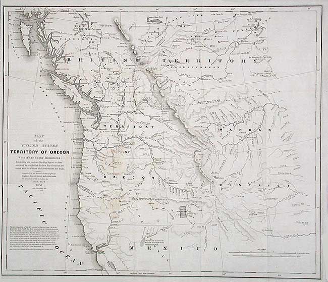
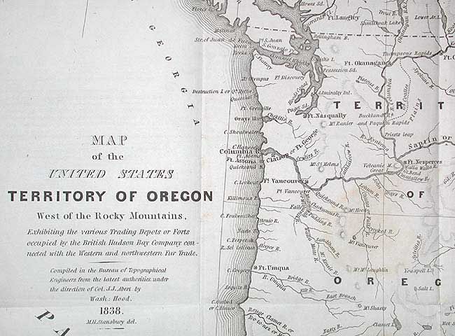
This map accompanied an important report intended to awaken public interest in the American occupation of Oregon Territory in the controversy with Great Britain, who also claimed the territory down to the Columbia River. A long notice at lower left is an ultimatum given to the British by Henry Clay, Secretary of State, stating that the 49th parallel would be the boundary. Among the many interesting details are the locations of the trading posts or forts connected with the northwestern fur trade, both American and British. The map is derived from Arrowsmith's 1832 map of British North America and covers present day Oregon, Washington, Idaho, Montana, and Wyoming. The region west of the Rocky Mountains is named Mandan District.. Much of southwestern Canada is also shown. Complete with the original 64 pp. report to Congress that was to accompany a bill to authorize the President to occupy the Oregon Territory. A very historically important map and report.
References: Wheat (TMW) #434; Hayes #197.
Condition: A
Folding as issued. Two very light stains, else map is near fine.